|
- More then 7000 weather stations works day and night all around the World.
- Now you can get a real-time meteo data from all of them.
- You can get also a history of meteo data for the past 1 - 60 hours.
- Care about your family, make a business trip, land a plane, sail anywhere safely!
How to use it:
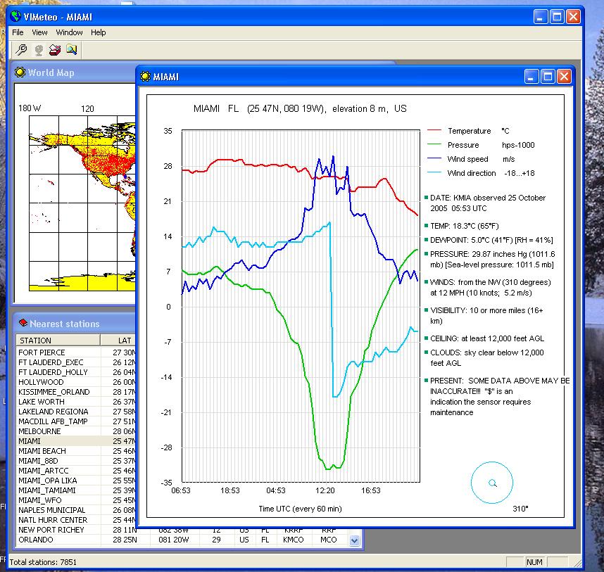
- double click on a worldmap for a list of a nearest stations;
- double click (or press Enter) in a list at a station you are interesting for;
- you will get a past 6 hours of meteodata for that station;
- then you will getting the new meteodata every 10 - 60 minutes (depending of station) automatically;
- use "Mark all stations" button for show all stations on the world map as a red points;
- use "Show all stations table" button for show a list of all stations;
- use "Find station" button for finding a station by a part of the name or by the ICAO code;
Parameters dialog:
- select a meteo data to show on a diagramm: temperature, pressure, wind speed, wind direction;
- set a USA style (Fahrenheit etc) or European style (Celsius etc);
- change the past time to show in a range of 1 to 60 hours;
- change the distance for looking around the double-clicked point on a world map (in minutes, 1 minute = 1 naut. mile);
- set write or not a meteodata for the current station to a txt file;
Tips:
- the changes you have made in a meteo part of Parameters dialog will be shown for the next opened station;
- in a list of stations use keys: "Home" for go to top, "End" for go to bottom, "Page Up", "Page Down" for scrolling, "Enter" for select a station;
- quickly select one of the last stations in menu "File";
- click a header of column in a stations list for sortinig a list by that column;

Keywords: weather, METAR, aviation, sailing, meteo data, real-time, diagramms, graphs, temperature, pressure, wind, business trip, world
|

Click to enlarge
|
Related programs in Business - Math & Scientific Tools |
|
Sailing Yachts Free Screensaver
Look at your desktop and see the amazing sailing yachts on it!
|
|
Logbook Pro
Pilot Logbook Software for PC, iPhone, iPad, Android
|
|
MetarWeather
Decode METAR weather reports, and display them in a simple weather report table.
|
|
MetaReport
MetaReport - powerful report generator.
|
|
Amazing Aircraft
This screen saver rotates 36 amazing photos of U.S. Air Force aircrafts
|
|
VIGps
GPS Navigator with using a scanned raster maps
|
|
Sidewinder Conveyor Design
Belt Conveyor Design Software
|
|
Bersoft Image Measurement
Measures an analyzes digital images. Includes image Database.
|
|
DRAGSENS
DRAGSENS - GPS Position of a Dragged Sensor - Transformation and tracking.
|
|
3D Grapher
Plot and animate 2D and 3D equation and table-based graphs with ease
|